Park at a Glance
- Size: 996km2
- The park was gazetted in 1991 and was recognized as a World Heritage site in 1994 and Ramsar site in 2008.
- Highest point: 5,109m above sea level on Mt Stanley’s Margherita Peak. Mt. Stanley is bisected by the border with the DR Congo.
- The Rwenzori is not volcanic like East Africa’s other major mountains but is a block of rock upfaulted through the floor of the Western Rift Valley.
- The Rwenzoris were christened the “Mountains of the Moon” by the Alexandrine geographer Ptolemy in AD 150.
- The explorer Henry Stanley placed the Rwenzori on the map on 24th May 1888. He labeled it ‘Ruwenzori’, a local name which he recorded as meaning “Rain-Maker” or “Cloud-King.”
The oldest recorded person to reach Margherita Peak was Ms Beryl Park aged 78 in 2010.
The Rwenzoris – the fabled Mountains of the Moon – lie in western Uganda along the Uganda-Congo border. The equatorial snow peaks include the third highest point in Africa, while the lower slopes are blanketed in moorland, bamboo and rich, moist montane forest. Huge tree-heathers and colorful mosses are draped across the mountainside with giant lobelias and “everlasting flowers”, creating an enchanting, fairy-tale scene.
Rwenzori Mountains National Park protects the highest parts of the 120km-long and 65km-wide Rwenzori mountain range. The national park hosts 70 mammals and 217 bird species including 19 Albertine Rift endemics, as well as some of the world’s rarest vegetation.
The Rwenzoris are a world-class hiking and mountaineering destination. A nine- to twelve-day trek will get skilled climbers to the summit of Margherita – the highest peak – though shorter, non-technical treks are possible to scale the surrounding peaks.
For those who prefer something a little less strenuous, neighboring Bakonzo villages offer nature walks, homestead visits home cultural performances and accommodation, including home-cooked local cuisine.
The different habitats generate a great diversity of species of rare plants and animals listed on the IUCN Red List. They include 70 mammals and over 217 species of birds including 19 Albertine rift endemics like Rwenzori Turaco, Rwenzori night jar. Any specialist birder and nature enthusiast watcher out there must visit this park for rare sightings.
There are extensive trails such as the Central Circuit Trail that give access to the summit glaciers with good hut accommodations. Plan your trekking expedition in advance and come prepared with technical logistics you need.
There are a variety of Rwenzori treks ranging from short day hikes to 12 Days including natural walks, hiking, bird watching and the memorable cultural encounters of the indigenous forest tribes of Bakonzo and BaTwa village visits featuring their myth of deity god, traditional cuisine, dance performances and storytelling, crafts
Located in western Uganda on border with DRC, the 437 km journey from Kampala to Kasese town approximately takes 7-8 hours drive. Spend a night in Kasese the nearest town with affordable lodges, guest houses and camping opportunities make it a backpacker’s dream destination.
Hiking the Rwenzoris
Hiking the Rwenzori Mountains is a unique and rewarding experience, but it’s important to be prepared both in terms of costs and expectations. At 5,109 meters, the mountains stand as the third highest on the African continent and the highest in Uganda and Democratic Republic of Congo.
Hiking Rwenzori ranges to its highest peak, margherita takes between 6-7 days and takes climbers through stunning nature and biodiverse mountain ecosystem.
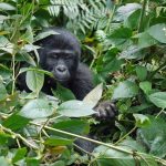
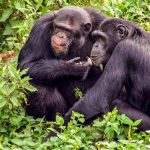
Margherita Peak which is notably Africa’s third highest peak offers its real beauty in the climb up through Kilembe route, the valleys, forests and flora is diverse with trees and variety of ferns. The trees are populated with numerous bird species and primates and as you walk up the trails there are endless chances of viewing chimp nests in the tall trees. Lucky climbers may catch a glimpse of the resident chimpanzee as they scamper away.
Climbing to the Margherita Peak is more of a hard scramble than a climb except for a few difficult moves across mountain terrain and during snow periods it becomes more difficult to navigate, however the rewards and exaltation of conquering the top is worth the efforts with clear views across Albert Peak to the DRC (Congo) then east across the spectra of the Rwenzori massif.
More information about Rwenzori mountains
Who can hike Rwenzori? Anyone from the age of 10 years is allowed to hike the mystic mountains for as long as he or she is physically fit and determinated. From the beginning of the hike, you will be escorted by a group of park rangers, porters who will be responsible of your belongings, and cooks who will prepare your meals.
Rwenzori hiking routes: There are two routes which will lead you to the summit, Margherita peak – Central Circuit and Kilembe route. The Central Circuit route is organized and managed by the Rwenzori Mountaineering Services and it starts from Nyakalengijja point while the Kilembe route, also known as the Southern route starts at Kilembe (1,450m) is managed by Rwenzori Trekking Services. During the hike, you will hike through different rainforests as the mountains are known for protecting six vegetation zones (savanna grassland zone, Afromontane forest zone, Bamboo forest zone, Afro-Alpine moorland zone, and lastly the Glacier/Rocky zone).
Hiking period of the Rwenzori: When one is physically fit, he or she can hike the adventurous mountains to the summit between the 5 to 7 days and the descend to the starting point. Although, you are not advised to move at a high pressure in order to avoid acclimatization (altitude sickness).
Costs of the Experience
The costs associated with hiking the Rwenzori Mountains can vary depending on factors such as the route you choose, the duration of your trek, the services provided, and whether you’re arranging the trip independently or through a tour operator. Here are some potential costs to consider:
Permits: You’ll need permits to enter the Rwenzori Mountains National Park. These permits cover park entry fees, Hiking fees, conservation fees, and community fees. Prices can vary for different routes and durations.
Guides and Porters: Hiring experienced guides is highly recommended for safety and navigation. Porters are also available to help carry your gear, which can make the trek more enjoyable. Guide and porter fees can vary.
Accommodation: Accommodation is typically in basic mountain huts or campsites along the trail. Costs vary based on the type of accommodation and the route you choose.
Transportation: Getting to the trailhead and back from the Rwenzori Mountains might involve transportation costs. This could include transportation to and from the nearest town or city, as well as transfers within the park.
Gear and Equipment: If you don’t have your own hiking gear and equipment, you might need to rent or purchase items such as boots, jackets, sleeping bags, and more.
Meals: Some trekking packages include meals, while others might require you to bring your own food or pay extra for meals provided along the trail.
It’s advisable to research different tour operators or guides, compare prices, and inquire about what’s included in their packages.
Expectations from the Rwenzori Hike
When hiking in the Rwenzori Mountains, there are a lot to expect and among these include;
Diverse Landscapes: The Rwenzori Mountains offer a variety of landscapes, including lush rainforests, bamboo forests, alpine meadows, and glacier-covered peaks.
Challenging Terrain: The trekking routes in the Rwenzori Mountains can be demanding, with steep ascents and descents, rocky paths, and sometimes slippery conditions. Physical fitness and some hiking experience are recommended.
Unpredictable Weather: Weather conditions can change rapidly in the mountains. Be prepared for rain, cold temperatures, and potentially even snow, especially at higher altitudes.
Unique Flora and Fauna: The mountains are home to a rich diversity of plant and animal species, some of which are endemic to the area.
Camping and Accommodation: Accommodation is basic, usually consisting of mountain huts or camping sites. Facilities can be limited, and you’ll need to be prepared for rustic conditions.
Altitude Considerations: As you ascend, you’ll be dealing with higher altitudes, which can lead to altitude-related symptoms like headaches, dizziness, and fatigue. It’s important to acclimatize properly and listen to your body.
Cultural Interaction: Depending on your chosen route, you might have the opportunity to interact with local communities and learn about their way of life.
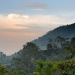
Breathtaking Views: The effort is rewarded with stunning panoramic views of the surrounding landscapes and, in some cases, distant peaks.
Remember that the experience can vary based on the route you choose, the duration of your trek, and your personal preferences. Proper preparation, including physical training, packing appropriate gear, and acclimatizing, will contribute to a safer and more enjoyable experience.

